Thank you! Really pleased with how it looks in print.
16 hours ago
2
0
0
0
Thank you! Really pleased with how it looks in print.

Photograph of a spread from the new DK book Atlas of Botany, with a vintaage-style map of the world designed by Mike Hall

Photograph of a spread from the new DK book Atlas of Botany, with a vintaage-style map of the world designed by Mike Hall

Detail of the front cover of the new DK title Atlas of Botany, featuring the outlines of the vintage-style world map designed by Mike Hall

Detail of the endpapers of the new DK title Atlas of Botany, featuring the outlines of the vintage-style world map designed by Mike Hall
🚨 New work: Really pleased to receive my complimentary copy of Atlas of Botany, a sumptuous new title from DK for which I designed a vintage-style base map of the world that is reproduced throughout the book and also appears on the endpapers and cover art. On sale next month!
dk.com/products/978...
“I’m a big admirer of Francis Bacon!”
“The artist?”
“No, not that one.”
“The philosopher?”
“No, not him either”
“…”
Two-step authentication, man. "Just checking it's you!" Yes, bank, it *is* me again, logging into my account for the umpteenth time on the same computer I've been using for the past ~5 years.
What do the other members of the "Board of Peace" have to say about all this?
Red = Castile
Blue = Aragon

Tweet by mtobey, text reads: “Anybody here named Jeff?” Jeff: “Yes” Geoff: “Yeos”
Another classic
Dismayed to realise that I've started humming podcast theme tunes to myself which probably indicates that I've been listening to too many of them recently
Surely I’m not the only one who thinks this whenever they see a map of The Strait Of Hormuz on the news?
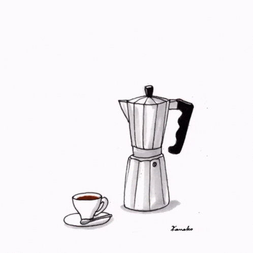
Now that I own a moka pot that I've realised I shouldn't scrub clean after every use in order to get a better-tasting cup of coffee, I get it.
Years ago I had a housemate who always drank his coffee from the same mug, which he would leave unwashed on the side in the kitchen. I found this strange and one day I decided to wash it for him, and he was *furious*.
I still have the box of staples I bought for my first year of secondary school 29(!) years ago, still more than half-full. I only require the use of a stapler maybe once, twice a month. My daughter will inherit them in my will.
Now *that’s* an AI-generated map if ever I saw one.
This posits a really interesting question I'd never considered before: where does the Iberian Peninsula start/end?
We'd all say the Pyrenees of course, but Google Maps apparently has other ideas (and it's not necessarily wrong)

Screenshot from a page on ConceptDraw.com Text reads: Example 3. Map of the British Isles Counties The United Kingdom map samples you see on this page were created in ConceptDraw DIAGRAM software using the drawing tools of the Map of UK solution. An experienced user spent 10-15 minutes creating each of these samples. Use the Map of UK solution for ConceptDraw DIAGRAM Solution Park to develop your own United Kingdom map and various UK related thematic maps quick, easy and effective.
...As for the labels, it looks like careless placement to me. Some got nudged by accident and left where they were (e.g. Leeds, Bradford) and Torksey was possibly added for a laugh/personal reasons.
⬇️ I also found this in a description of one of the other maps. 10-15 minutes sounds about right 😂

Screenshot of a map of England’s regions available from ConceptDraw.com. Where do we start. Although the regions themselves are broadly correct, the boundaries are a mess. They largely follow the historic counties of England, which were abolished in the early 1970s. These have been mixed with some newer boundaries: part of the line between the Yorkshire and the Humber region and the East Midlands region follows the southern boundary of the former county of Humberside (abolished 1996). While the actual Yorkshire and the Humber region does follow this boundary, it is anachronistic with the other boundaries shown. Similarly, the London region is shown as a combination of Middlesex (abolished 1965) and the southern half of Greater London, with its boundary running through Surrey and Kent; east London meanwhile is incorrectly shown as part of Essex (as it once was). All in all, it's a dog's dinner.
*Puts expert hat on*
I don't believe this is AI. The boundaries are wrong, but too precise. I'd suggest it's the work of someone with little knowledge of English geography who has mashed together historic county boundaries with some modern ones (I refer you to the attached image and ALT text)...
Hertfordshire has also reclaimed Chipping Barnet and Totteridge.
A very weird mashup of ancient and modern county boundaries going on here!

Tube Map from 2006 in which all of the station names are replaced by anagrams. Highlights include Pig Pen (Epping), Swearword & Ethanol (Harrow & Wealdstone), Burst Raccoon (Barons Court) and Queer Spank (Queen's Park).
Been reminded this morning of the existence of the Anagram Tube Map (thx to @diamondgeezer.bsky.social's latest blogpost) wharferj.wordpress.com/wp-content/u... ("This train is for Pig Pen. The next station is Yeti Witch").
Tag yourself, etc. Also: didn't the Tube Map look SO much better back then?
Hallelujah 🙌🏻 One down, two to go.
bsky.app/profile/bsky...

Screenshot of Wes Streeting being interviewed on BBC News in summer 2020, with a framed copy of Mike Hall's London Borough of Redbridge map in the background behind him
If Wes Streeting replaces Keir Starmer, it'll be exciting news for me at least as he'd be the first British Prime Minister (that I know of) to own a Mike Hall Retro London Borough map
KEEP CLEAR OF ME
The most blatant AI-generated crap dripping in gold. Totally on brand.
Update: they made another one! And it's still dogshit 💩
(h/t @patrickstotz.bsky.social)
bsky.app/profile/patr...

Cover of the book The Boroughs of London by Mike Hall and Matt Brown, published by Batsford Books

A page from the book The Boroughs of London by Mike Hall and Matt Brown, showing the introduction and a map from the Southwark section

A detail of a page from The Boroughs of London by Mike Hall and Matt Brown, showing colourful statistical maps of Greater London

Detail of a page from the book The Boroughs of London by Mike Hall and Matt Brown, showing text and illustrations in the Wandsworth section
Well blow me sideways. Today I received the delightful news that The Boroughs of London by me and @mattfromlondon.bsky.social has been shortlisted in the Trade Illustrated category in the British Book Design & Production Awards 🥳
www.britishbookawards.org/shortlist-20...
"What do Scottish people like?"
"Irn Bru and... Tunnocks?"
"Great. Get that sad-looking sandwich in there too, this is supposed to be a meal after all. And me looking important with a ringbinder."
"Got it."
"Oh don't forget that weird photo of some pipes behind me"
"Done. Share?"
"Great work team"
It looks like they tidied it up a little for the Big Presentation earlier (still looks bad though)
bsky.app/profile/this...
I don't speak Dutch though I think I've figured out what "Logo van de oranje clown" means 😉

